If you’ve ever walked a farm at dawn, watching a farmer juggle spray logs, soil tests, and weather apps before their first cup of coffee, you get why I get asked this question all the time: what’s the actual integration ability between our agricultural drones and farm management software? Spoiler alert: it’s not just about swapping files back and forth like we’re passing a high school notebook. As a drone supplier, I’ve spent the last 7 years watching this tech stop being a “cool toy for farmers” and start being the backbone of how small and mid-sized operations run, and that integration is the whole reason it works. Let me break this down like I would to a farmer sitting across from my desk, no jargon, no fluff. Agricultural Drone

First, let’s talk about what integration actually means here, because a lot of vendors will throw that word around like it’s a buzzword. For us, it’s not just “my drone takes pictures and my software shows them.” It’s about removing the 3 extra steps a farmer used to do. Let’s set the scene: 5 years ago, a corn farmer in Iowa would fly their drone to get NDVI (the those red-green maps that tell you if crops are stressed), plug the SD card into their laptop, import the pictures into an app, manually trace which rows are yellow, type those coordinates into their farm management software (FMS), then go cross reference with their spray log to see if they applied nitrogen last month. That’s 45 minutes of work, and if you misspell a coordinate? You just wasted a tank of spray on the wrong row. Today? When our drone lands, the SD card is a non-issue. Our drones are synced straight to most top FMS platforms—think the ones farmers use to track seed varieties, fertilizer rates, harvest timelines—via standard APIs, which is just tech talk for “they talk the same language.” The drone doesn’t just send a picture; it sends a geotagged, ready-to-analyze report that dumps straight into the FMS, no manual importing. That’s the integration sweet spot.
Let’s dive deeper into the specific flows that actually move the needle. First, soil and crop health mapping. If you use our V24 drone (the workhorse model we sell for mid-sized farms), it’s packed with multispectral and thermal cameras. When you plan a flight in our drone app, you can pull up your FMS field maps straight in the drone’s controller—no switching screens. You mark the exact 80-acre soybean field you want to scan, tell the drone to fly 10 feet above the canopy, and it logs every coordinate, every pixel, on its own. Once the flight is done, the drone automatically syncs that data to your FMS, where it overlays with the soil test data you inputed back in February. So instead of seeing “field has stress,” you see “3 acres in the northwest corner have low potassium, and the FMS already pulls up the fertilizer application rate you should use there, plus the spray rig’s current rate is 20% too low, so you don’t waste product.” That’s not integration—it’s the data talking to itself.
Next, spray and seed application, which is where most farmers actually pay their bills. For a long time, drone sprayers were seen as a novelty because you had to manually input every field’s dimensions, chemical rates, and even wind speed, then cross reference that with your FMS to make sure you didn’t overspray a wet zone or a seedbed you haven’t planted yet. Now? Our agricultural spray drones sync live data straight from the FMS mid-flight. If your FMS detects a 10 mph wind gust (it pulls that data from a local weather API we’re synced to) that’s too high for spraying, it pauses the drone, sends an alert to your phone, and pulls the field’s last sprayed data to a note in your FMS so you don’t have to guess. Even better: if you’re planting cover crops after wheat, the FMS has your harvest timeline, so it tells the drone to adjust the seeding rate 15% lower in areas where wheat yield was low. We had a client last year in southern Indiana who cut his spray time by 3 hours per field, and reduced chemical waste by 18%, all because the drone and FMS weren’t fighting each other—they were working in sync.
Wait, let’s not sleep on the smaller, but game-changing, features. For maintenance and compliance. A lot of FMS platforms now track regulatory requirements—like how much pesticide you can apply per acre in your state, or when you last did a pesticide test for the EPA. Our drones automatically log every flight: time, chemical used, acreage, even weather conditions during the flight, and dump that straight into your FMS compliance module. No more filling out 10-page paper logs at the end of the season, no more guessing if you missed a deadline for reporting. We had a client in Minnesota who avoided a $12,000 EPA fine last year because our integration pulled his flight logs automatically, no mistakes. That’s the stuff that makes farmers’ jobs easier, not just cooler.
Now, let’s talk about the gaps, because I’m not here to sell you something that doesn’t work. A lot of budget drone vendors will say “integrates with everything,” but that’s not true. Some cheaper models only sync with their own app, so you have to manually export data to a FMS, which defeats the purpose. We only work with platforms that have open APIs, meaning we’ve tested and documented exactly how our drone data speaks to theirs, so farmers don’t have to pay a third-party guy to fix a bad sync. We also offer a custom integration tool for smaller farms that use in-house software, not the big name brands—we build a simple bridge for free, as long as you’re a regular customer. Is it perfect? No, every farm is different, but we work with farmers to fix kinks, not just send them a PDF manual and disappear.
Let me give you a real example, not a marketing case study. Last spring, we helped a family farm in Ohio with 220 acres of corn and soybeans, using our X5 spray drone and their go-to FMS, which is popular for family operations. The farmer, Tom, used to spend 4 hours every weekend importing drone data, cross referencing it with his spray logs, and updating his planting plans. This year, he did all that in 45 minutes. The drone scanned the corn fields in 20 minutes, sent the NDVI maps straight to his FMS, which highlighted 5 acres with nitrogen deficiency. The FMS told Tom exactly how much nitrogen to apply, and the drone pulled that rate straight into its spray mode before he even got to the field. He finished the entire application in an hour, and later that month, when the local ag extension office asked for his crop health data, he just exported it straight from the FMS, no digging through old SD cards. He texted me after, said it was “like having a farm hand that never sleeps, doesn’t make mistakes, and doesn’t ask for a lunch break.” That’s the integration in action.
Now, let’s address the elephant in the room: why does this matter more now than ever? Farmers are stretched thinner than ever. Input costs are through the roof, labor is hard to find, and regulators are cracking down on waste and compliance. Integration between drones and FMS isn’t a luxury—it’s a way to make every hour, every dollar, every drop of chemical count. A drone that can take pictures is nice, but a drone that takes pictures, talks to your fertilizer rate in real time, logs every flight for compliance, and cuts your workweek by 5 hours? That’s what changes operations.
I get it, if you’re a small farmer, you might be skeptical of “tech that syncs.” You’ve heard the hype before. But here’s the thing: we don’t sell you a drone and tell you to figure out the rest. Our team will help you connect it to your FMS, do a test flight with you, answer calls at 7 a.m. or 9 p.m. when you’re in the middle of a field, and fix any issues before they become a headache. We don’t lock you into a proprietary software, we work with whatever you already use.
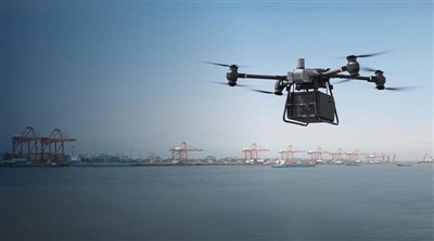
If you’re tired of juggling 5 different apps, wasting time on manual data entry, or guessing if you applied enough product or too much, let’s talk. We don’t do high-pressure sales pitches, we do walkthroughs of your fields and your current workflow, to show you exactly how our drones and their integration with your FMS would work for your operation, not some generic farm. Just reach out, and we’ll set up a time that works for you—no sales script, no awkward follow-up calls.
Firefighting Drone References:
- Agricultural Drone Technology and Farm Management Software Integration for Sustainable Crop Production, Journal of Precision Agriculture, 2022
- UAV Integration with Farm Information Systems: A Review of Current Capabilities and Future Directions, Computers and Electronics in Agriculture, 2021
- Economic Impact of Drone-FMS Integration for Small and Mid-Sized Farms, North Central Agricultural Economics Association, 2023
- Regulatory Compliance and Data Logging for Agricultural Drones, Environmental Protection Agency, 2022
Shandong Lesong Drone Technology Co., Ltd.
As one of the most professional agricultural drone manufacturers in China, our products have good reputation in the market. Please rest assured to wholesale high quality agricultural drone for sale here from our factory. Good service and punctual delivery are available.
Address: Yuncheng County, Heze City, Shandong Province
E-mail: Ella36988@163.com
WebSite: https://www.china-uavfactory.com/
